Displaying Shapes using a Shapefile
In This Topic
Shapefile is a popular vector data format for geographic visualization of data. It represents data using vector elements such as polylines and polygons. This type of file is usually stored in two formats:
- .shp - A file with shp format comprises data about vector elements
- .dbf - A file with dbf format comprises the attributes of the vector elements in the corresponding shp file.
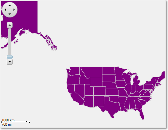
The following code loads both the shp and dbf format files using C1.FlexMap.ShapeReader class and adds the loaded data to the vector layer on a map:
In the above code, we have referred a class named MapReader that we have created. This class reads the vector data from the shp and dbf files.
On adding shapes from shp and dbf files, the map will look similar to the image given below: