This section details with basic C1Maps concepts and describes the main properties.
Map Source
C1Maps can display geographical information from several sources. By default, the Maps control uses Microsoft LiveMaps aerial photographs as the source, but you can change that using the Source property in C1Maps class, which takes an object of type MultiScaleTileSource.
The following sources are included:
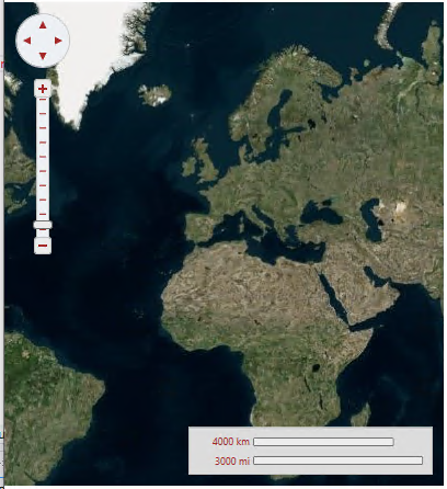
Setting the Source property to an instance of VirtualEarthAerialSource class, lets the MultiScaleTileSource object type access Microsoft's Virtual Earth aerial tiles.
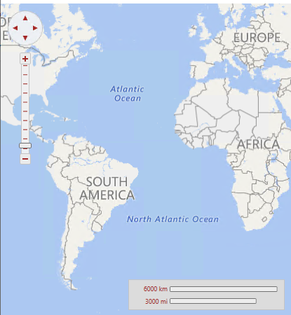
Setting the Source property to an instance of VirtualEarthRoadSource class, lets the MultiScaleTileSource object type access Microsoft's Virtual Earth road tiles.
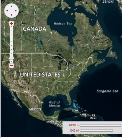
Setting the Source property to an instance of VirtualEarthHybridSource class, lets the MultiScaleTileSource object type access Microsoft's Virtual Earth hybrid tiles.
Visibility
The portion of the map that is currently visible is determined by the Center and Zoom properties, and by the size of the control:
The Center property is of type Point but it actually represents a geographic coordinate in which the X property is longitude and the Y property is latitude. The user can change the value of the Center property by dragging the map with the mouse, or by using the navigator control shown on the left top corner.
The Zoom property indicates the current resolution of the map. A zoom value of 0 has the map totally zoomed out, and each increment of 1 doubles the map resolution. The user can change the value of the Zoom property using the mouse wheel or the zoom control on the left side of the control.
Coordinate Systems
C1Maps uses three coordinate systems:
C1Maps provides four methods for converting between these coordinate systems: ScreenToGeographic, ScreenToLogic, GeographicToScreen, and LogicToScreen. The conversion between geographic and logic coordinates is done by the projection configured using the C1Maps.Projection property. The projection can be changed to support a different map, the default is the Mercator projection used by LiveMaps and most other providers.
Information Layers
In addition to the geographical information provided by the source, you can add layers of information to the map. C1Maps includes five layers by default: